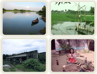
Anihola Union is 25 km north to the Tanngail district head quarter. And 10 (km) south west to Ghatail Thana. Bhuapur Thana head quarter is 8 km North West to the Anihola Union. The well known Jamuna river is 12 km west to the Anihola Union. Anihola situated in the middle of Bhuapur, Ghatail and Kalihali Thana town. The Jinai river which is the branch of JamunaRiver goes through this village.
Source: UP, Local people.
ITEM
FIGURE
RANK
Area
5,698.00
A
2641
Population
24,108.00
P
1824
Density of Population
4.23
P
1557
Literacy Rate
44.00
%
1744
NER in Primary Education
62.96
%
421
Girls' NER in Primary Education
62.43
%
489
Improved Sanitary Latrine
39.74
%
1444
Improved Drinking Water Source
92.42
%
2107
Electricity Connection
11.41
%
2867
Source : BBS
As on (Date): Jan 27, 2001
Visitors
GB 69 US 58 EU 8 RU 7 CA 7 FR 6 IT 2 NL 2 IL 2





 GB 69
GB 69  US 58
US 58  EU 8
EU 8  RU 7
RU 7  CA 7
CA 7  FR 6
FR 6  IT 2
IT 2  NL 2
NL 2  IL 2
IL 2